
Ocean mapping: Habitat, water depth and water quality mapping, species distribution mapping
UAV-based solutions: Ultra-high resolution 3D mapping of terrestrial and marine targets
Software development: Plugin/tool development for ArcGIS and QGIS, R/Python code development
Training: Professional development/training of geospatial analysts
Liquid Geomatics is geomatics consulting company founded in 2017 to provide innovative and robust solutions to challenges involving geospatial data. Liquid Geomatics has unique expertise in the following fields:
Liquid Geomatics provides consultancy services in the fields of geospatial data acquisition and analysis. Common services include land and water mapping projects, research, algorithm and software development, and training.
Mapping solutions: Whether based on satellites or UAVs, Liquid Geomatics provides mapping solutions for terrestrial and marine targets. We specialize in developing innovative geospatial data processing algorithms, translating the results into map products with state-of-the-art accuracy and scale
Software development: We have extensive experience integrating data processing algorithms into user-friendly tools with familiar interfaces, using plugin/tool development for ArcGIS and QGIS
Training: We conduct workshops for professionals, focusing on the theory and practice of specific geospatial data processing tasks. Workshops within our area of expertise are provided upon request
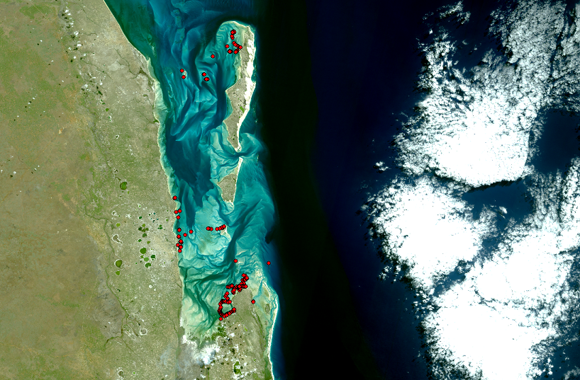
Liquid Geomatics is involved in a range of projects to map the geographical distribution of species. With external partners across the North Pacific region, we are developing maps of deep-sea benthic fauna such as cold-water corals and sponges for the North Pacific, and in collaboration with Brazilian and Swedish researchers we are developing regional maps of coral reef fishes in tropical nearshore environments.
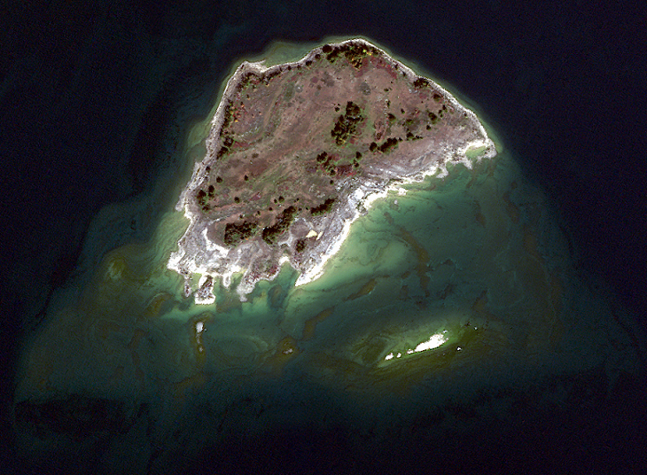
Information on water depth is essential for maritime navigation and coastal infrastructure projects, yet water depth remains unknown in most of the Canadian Arctic. Liquid Geomatics is developing innovative hybrid approaches to mapping water depth from satellite imagery, with the goal of enabling hydrographic services across the Arctic region to increase their use of satellite data.
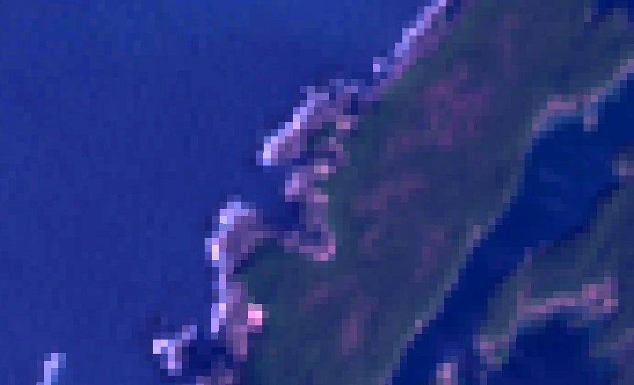
Liquid Geomatics is using the historical archive of satellite imagery from Landsat 4-8 as well as newer Sentinel 2 imagery to map long-term changes in kelp distribution along the US and Canadian Pacific coast. Kelp is a keystone species that creates habitat for numerous other species. Insight into the long-term spatial dynamics of kelp will improve our understanding of how both climate change and direct human impacts are likely to shape Pacific coastal ecosystems in the coming decades.
We're happy to hear from you. Expect a response within 1 business day
SERVICES
Liquid Geomatics provides consultancy services in the fields of geospatial data acquisition and analysis. Common services include land and water mapping projects, research, algorithm and software development, and training.
PROJECTS
We have completed a wide range of projects for Canadian and foreign organizations, including terrestrial and marine mapping projects employing the full range of remote sensing technologies (UAVs, manned aircraft, satellites).
CLIENTS
Our clients primarily include governmental and non-governmental entities. We collaborate on our projects with governmental, academic and private-sector partners to deliver state-of-the-art solutions.
